MapLarge 511
The statewide traveler information platform built for purpose.
Know Before You Go
Keeping that promise means one accurate answer about an entire road network, available to a trooper, a road crew, a news desk and a driver at the same moment.
Contact Us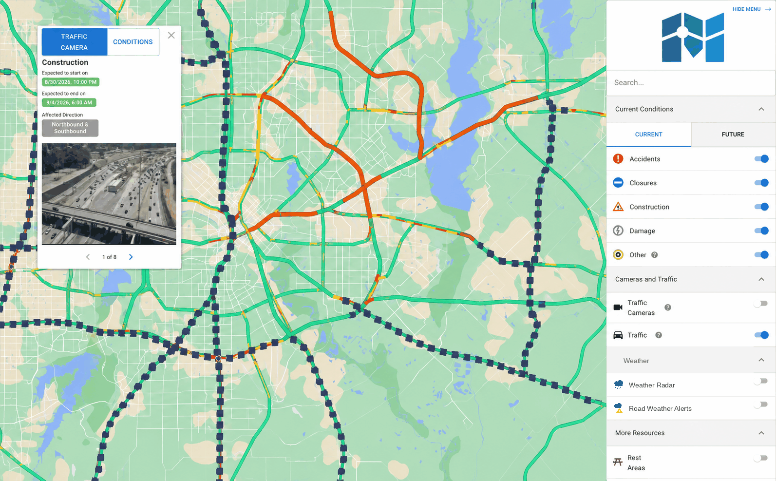
Six Things a 511 Has to Get Right
Any map works on a quiet Tuesday. These six decide what happens when it is not.
Reliability that matters for emergencies
Emergencies increase traffic from thousands of users to millions in minutes. MapLarge 511 scales ahead of that on its own, under a mission-critical SLA.
One answer the public can trust
Crews report incidents, closures and clearing times from a single portal. Those reports land on the same map as your sensors, cameras and weather feeds, so the public and your operations floor are never working from different information.
Know before the phones start ringing
Computer vision reads the camera feeds you already own and flags a blocked lane without anyone watching a wall of monitors. Forecast models combine historical traffic, weather and incident patterns to show where conditions are likely to deteriorate before they do.
Reroute an evacuation in seconds
An operator drops a barrier on a flooded segment and routing recalculates across the whole network. Evacuation routes and contraflow status publish as conditions drivers can actually follow.
New feeds without a new contract
Plow AVL, road weather stations, flood gauges, probe speeds, crash records, utility outages. Each one becomes a public layer through configuration, and nothing limits you to transportation data.
Security review, already handled
FedRAMP and GovRAMP certified, with access control down to the cell and audit logs your security office can inspect. Field crews keep working through outages and sync when the network comes back.
Configured for Your State
Your branding, your road network, your feeds, your condition types. A winter state turns on plow tracking. A coastal state turns on contraflow. Same platform underneath, same SLA.
What Is Included
Everything a 511 program runs, and the platform underneath it.
Traveler Channels
- Public web conditions map, mobile-optimized
- Native mobile application
- 511 phone IVR with natural language
- Personalized route and area alerts by email, SMS, and push
- Live traffic camera network at statewide scale
- Travel times, speeds, and delay
- Weather conditions and road weather alerts
Operations & Data
- Crew condition-entry portal with unlimited operator accounts
- Work zones and future-dated construction
- Automatic Vehicle Location (AVL) tracking
- Truck restrictions, parking, and commercial vehicle modes
- No-code ETL workflows and dashboard builder
- Open standards in and out: OGC, WZDx, GeoJSON, REST APIs
Platform Advantages
- Mission-critical SLA
- FedRAMP and GovRAMP certification
- Predictive condition forecasting
- Computer vision on existing camera feeds
- Barrier-aware evacuation routing
- Offline and edge operations for field crews
- Fusion of non-transportation data sources