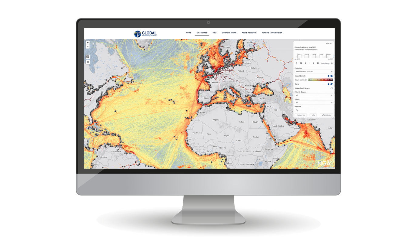
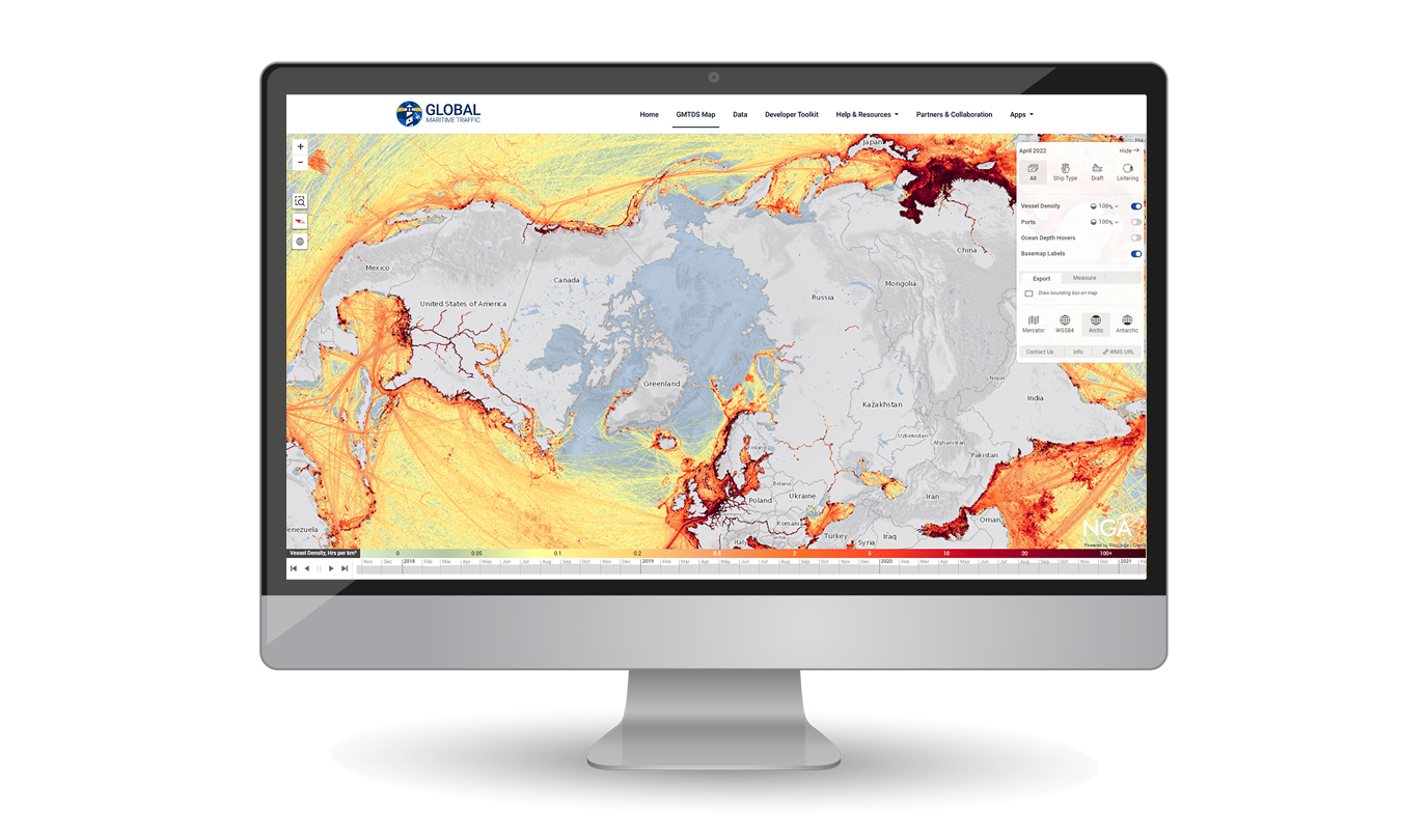
MapLarge's Global Maritime Domain Awareness Portal provides historic and up-to-date vessel activity patterns, providing both automated and manual analytic capabilities in support of distributed maritime operations.
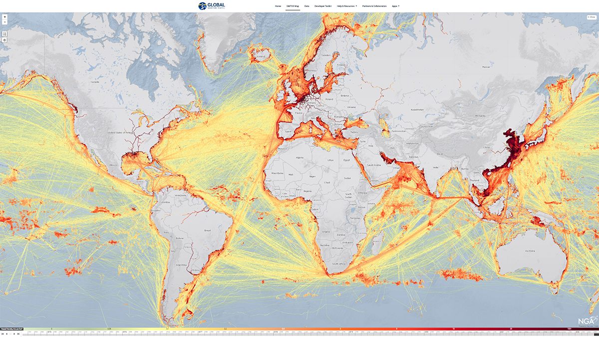
- Access 100B+ multi-source AIS messages as 1 km2 traffic density rasters over 10+ Years.
- Acquire/integrate additional multi-source data.
- Employ analytics toolkit with ELT and AI tools.
- Use in disconnected operations on small SWaP-C platforms or scale-up in the cloud..
Enhance Distributed Operations Mission Effectiveness with Global Activity Patterns:

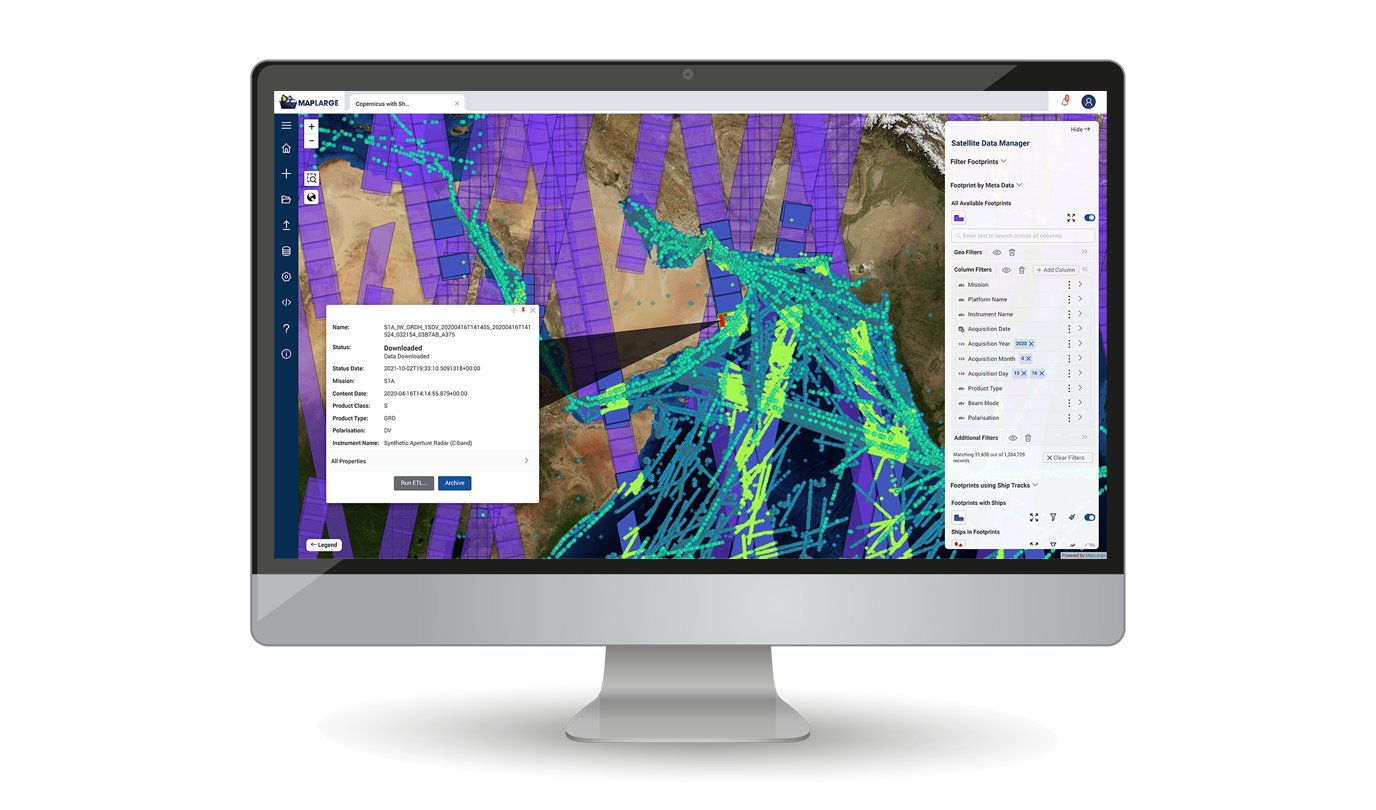
Acquire Multi-Source Analyst-Ready Data
Vendor agnostic solution acquires and integrates stovepiped multiple sensor phenomenology data making it user ready for data export, manual analysis, and automated workflows.
A Government Agency uses MapLarge to provide a public global maritime vessel traffic web-service to disseminate vessel traffic information to the world.

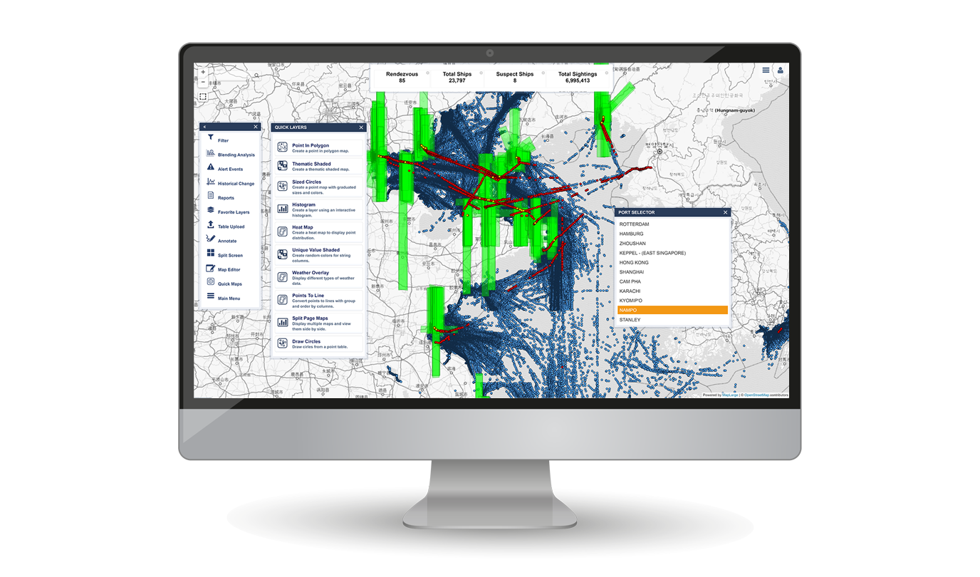
Analyze Activity Patterns and Associated Imagery Products
Use MapLarge’s out-of-the-box analytics, including a web app Electronic Light Table (ELT) toolkit, to analyze AIS and complementary multi-source data (vector or raster), including EO, SAR, RF, ADS-B, etc.
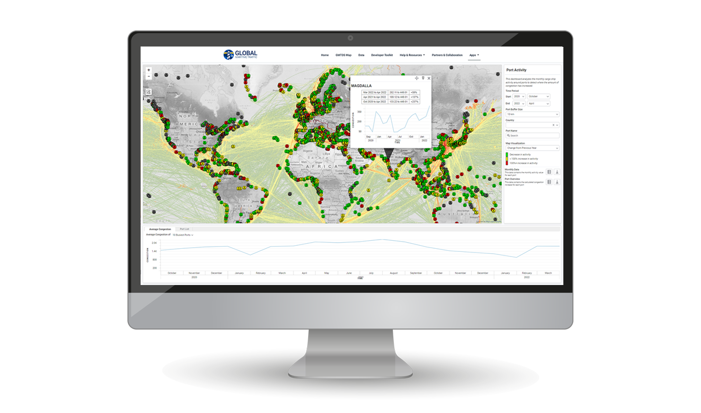
A Government Agency uses MapLarge to unify and synthesize over 250 different endpoints, with millions of geospatial data objects, into a state-of-the-art user experience to reduce time from analysis to production through a single queryable and accessible service

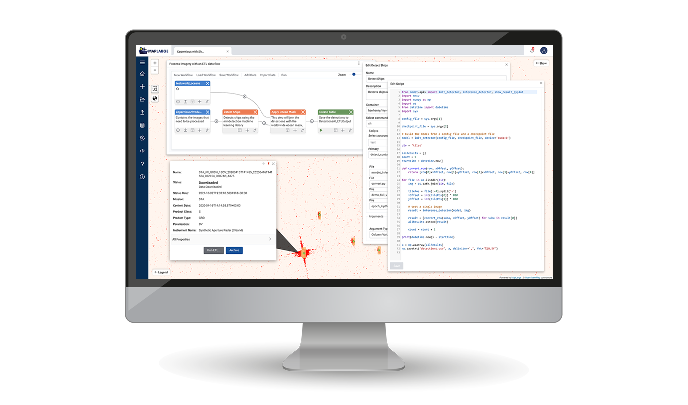
Automate Analytic Tradecraft in Push-button Workflows
Expedite speed-to-mission value by reducing repetitive, time-consuming analytic tasks. Prototype point solutions in MapLarge's workflow builder to grow a catalog of automated capabilities.
A MapLarge Customer uses MapLarge for productization of the data from raw and unprocessed to cleansed and published. The Extract, Transform, and Load (ETL) workflow builder tailors the data experience for end-customers. Once the interactive process data flow is defined, future updates require only a push of a button to quickly publish new content.