Maritime Awareness & Safety
Visualize global maritime traffic patterns by leveraging decades of historical Automatic Identification System (AIS) location data.
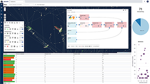
Real Time Transportation Visibility
Gain real time insights into the location and condition of maritime assets and cargo anywhere on the globe.
Deep Learning & Computer Vision
Use specialized algorithms to identify vessel location, speed and course from satellite and aerial imagery.
Port Management
Coordinate the movement of trucks, vessels and containers by tracking their location and status in order to optimize the flow of goods through the port.
Transportation Management
Optimize shipping and transportation needs by consolidating shipments, finding the most efficient routes and vessels, and managing customs and other key documentation.