Synthesize Multi-Source Data in Low-Latency Workflows for Time-Sensitive Operations
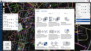
Enterprises collect multi-source textual, logical, temporal, and spatial multi-sensor data that can create multiple siloed solution stacks that don’t integrate workflows, are not agile for rapid assembly, or compromise on performance. MapLarge’s multi-model database overcomes these limitations by serving as an abstraction layer over multi-structured data warehouses and lakes adding queries, constraints, ACID transactions, and other functionality. In addition to supporting all major clouds, MapLarge also natively contains all these capabilities and can run on premise or offline with no external dependencies.
Utilize Fast Cache and Performant APIs to Accelerate Your Workflows
The MapLarge API may be integrated as a component of a larger solution or architecture using open standards. MapLarge is designed to supplement existing systems as a building block rather than replacing them entirely. The platform can communicate with nearly every layer of the enterprise from data to client. Thus the customer may choose to leverage the MapLarge Platform primarily in three ways: (1) as a full stack GIS platform (2) to enhance user facing applications as a fast cache or (3) to provide data dissemination operations at the machine-to-machine level.


Improve DevOps Productivity with Minimal System Configuration Requirements
MapLarge’s multi-model database is ideal for high performance multi-source use cases requiring minimal configuration. This multi-model approach allows dynamic query of the data and exploration of logical relationships with graph query support. Multi-Model Databases have inherent advantages and benefits, particularly:
Unite Your Edge, Disconnected, On Premise, & Cloud Deployments
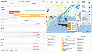
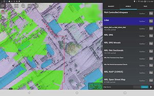
The entire MapLarge stack including the database can run offline or with intermittent connectivity on any iOS, Android, Windows, Linux, or RaspberryPI edge client with zero trust, federated data user, row and cell-level security. Deployments can also scale in the cloud horizontally to thousands of servers to support many of the largest spatial workflows in the world like continuously monitoring the near real-time location of nearly every plane in the sky and boat in the ocean.
