Automated Commercial Data Workflows Providing Ops-Ready Intel for Tactical Users
MapLarge's open standards platform provides a vendor-agnostic, high performance geospatial technology stack integrating diverse commercial space products for one-stop tasking, collection, processing, exploitation, and dissemination (TCPED). Expedite actionable intelligence from space-based sensors to tactical users on any platform or device.
- Activity-model alerts and sensor tip & cue.
- Federated tasking & search among vendors.
- Automated ISR analytics tool suite.
- Ready for use in tactical mobile gear, i.e., TAK.
- No ITAR restrictions for Mission Partners.
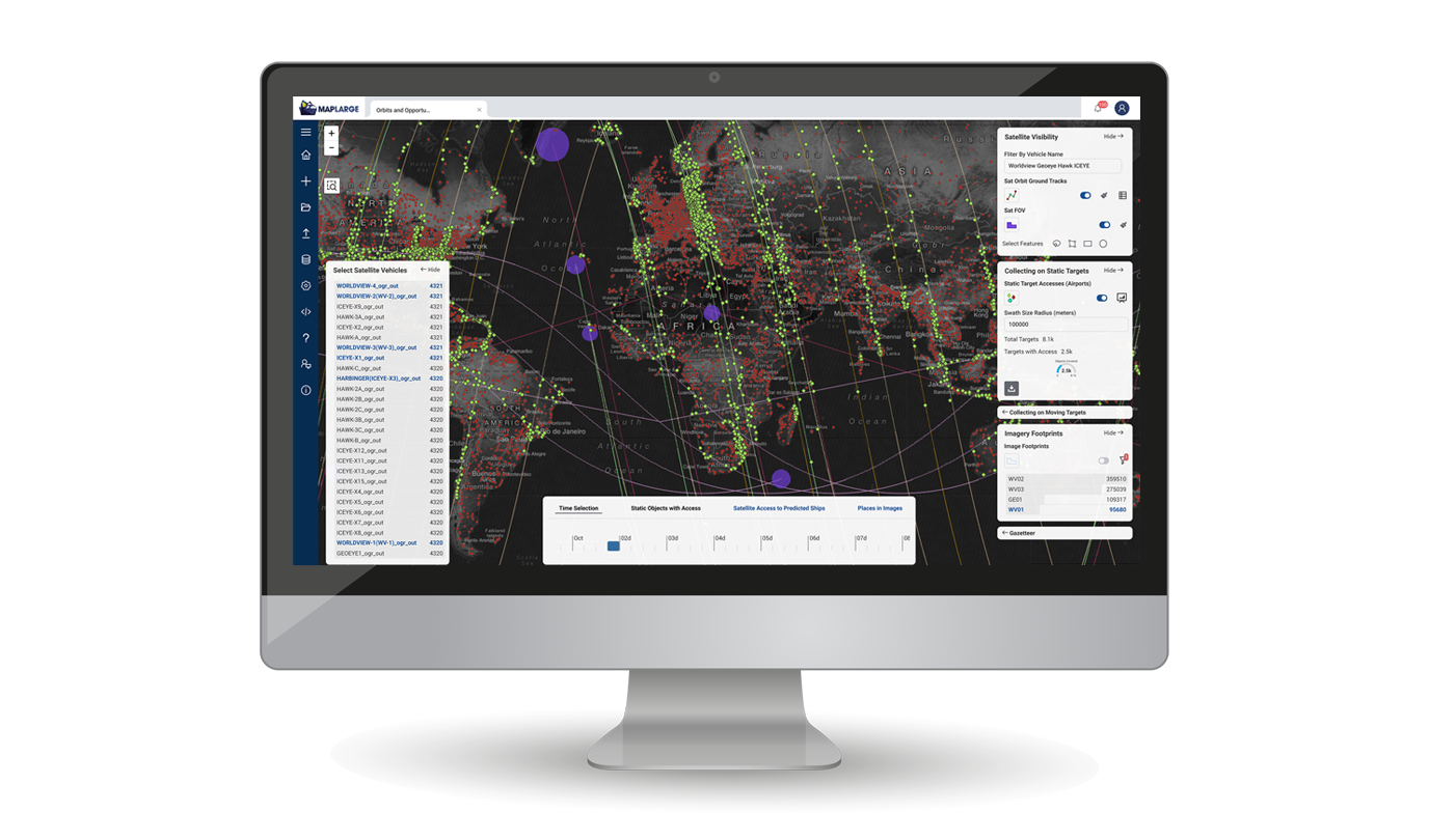
Deliver Integrated Commercial Multi-source Intelligence for All Mission Users

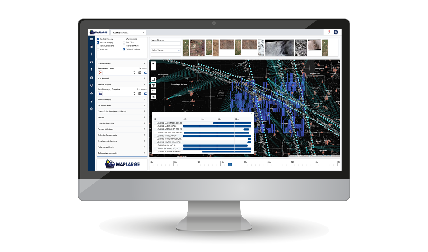
Unify Commercial Data Archival & Tasking Access in a Common Interface
COTS TRL 9 solution integrates stovepiped vendors into a common framework, spanning pre-mission planning, live operations, and post-mission PED for collaboration among ISR Ops/Intel stakeholders.
A Government Agency uses MapLarge to unify and synthesize over 250 different endpoints, with millions of geospatial data objects, into a state-of-the-art user experience to reduce time from analysis to production through a single queryable and accessible service.

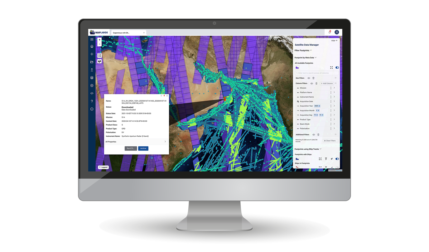
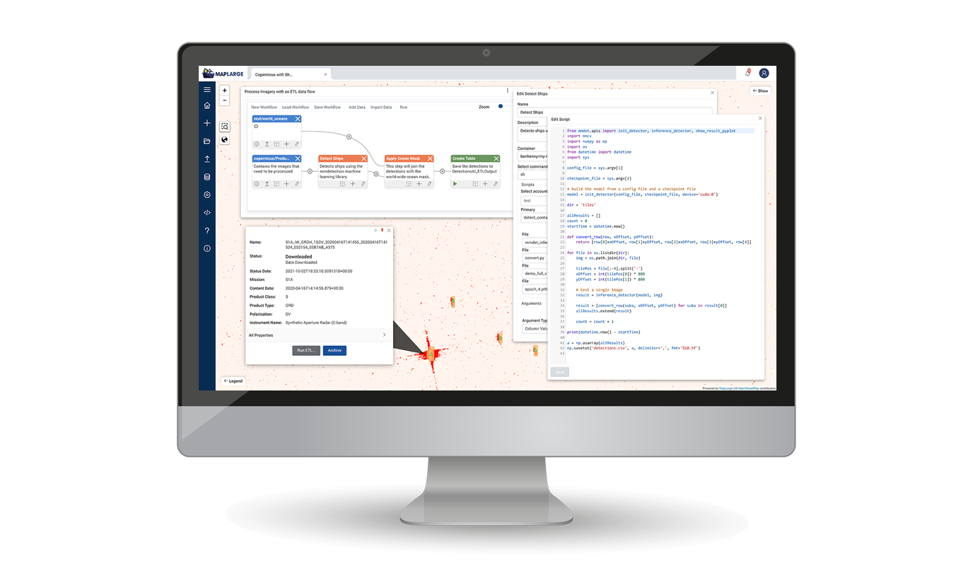
Automate TCPED Workflows from Activity Detection to Product Dissemination
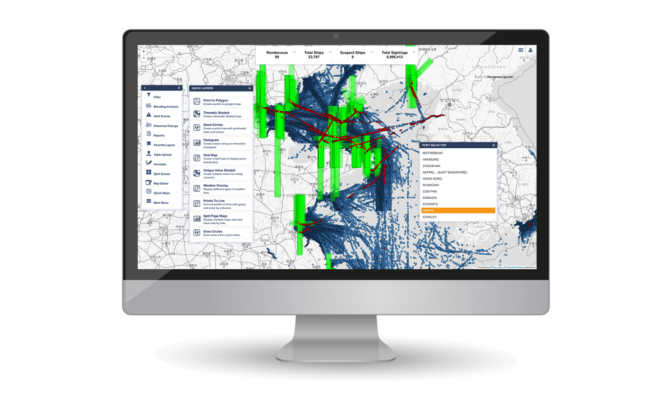
Derive intelligence from integrated multi-sensor (RF, AIS, EO, OPIR, LiDAR, SAR, HSI, OSINT, etc.) data, streams, data lakes, and data stores with performant ingest, query, transforms, analytics, and visualizations.
MapLarge supports the world's largest online subsurface seismic data marketplace enabling provisioning, data governance, system state, and brokering services across all of the first, second, or third-party systems participating.

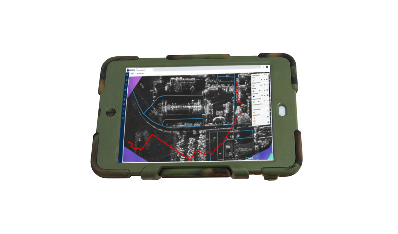
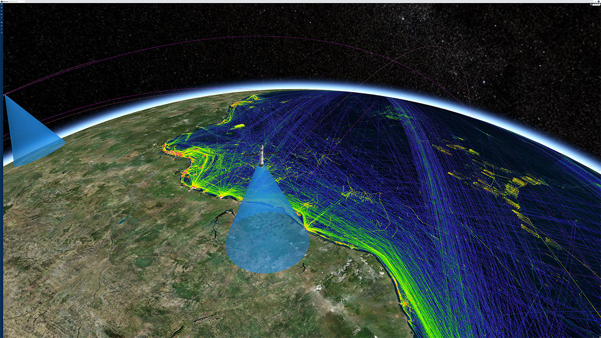
Accelerate Intel to Airborne, Maritime, & Ground Tactical Operations Users
Expedite validated data and products to tactical users on mobile handheld, forward PED, and Airborne ISR deployments, including Denied, Disrupted, Intermittent, and Limited-bandwidth (DDIL) ops support.
A MapLarge program provides a compromised asset interdiction suite (software + custom IoT hardware) for Federal/State Law Enforcement to combat cyber financial crimes in the field.