Rapidly Build Apps Using High-Performance Location Analytics
MapLarge enables no-code application creation through a UI Component library offering intuitive product creation, interactivity, and live data editing. Library components natively work together and integrate with data sources, allowing for unique solution engineering tailored to the use case, without re-inventing the data platform, data pipeline, or spending valuable time on inefficient boiler plate development.
Help Any User Create Data Science Apps with No Coding Required
MapLarge's WYSIWYG, no-code dashboard provides analysts and domain experts (non-developers) an intuitive drag-and-drop framework to visualize, analyze, and share data products. Grow a portfolio of GIS, BI, and hybrid dashboards to address use cases across the enterprise with MapLarge's catalog of maps, charts, KPIs, and advanced geospatial analytics components.
NO CODE APPLICATION CREATION

Hundreds of UI Components

Maps, Charts, Graphs & KPIs
HIGH DEFINITION

Visualize at High Definition

Inspect Individual Records
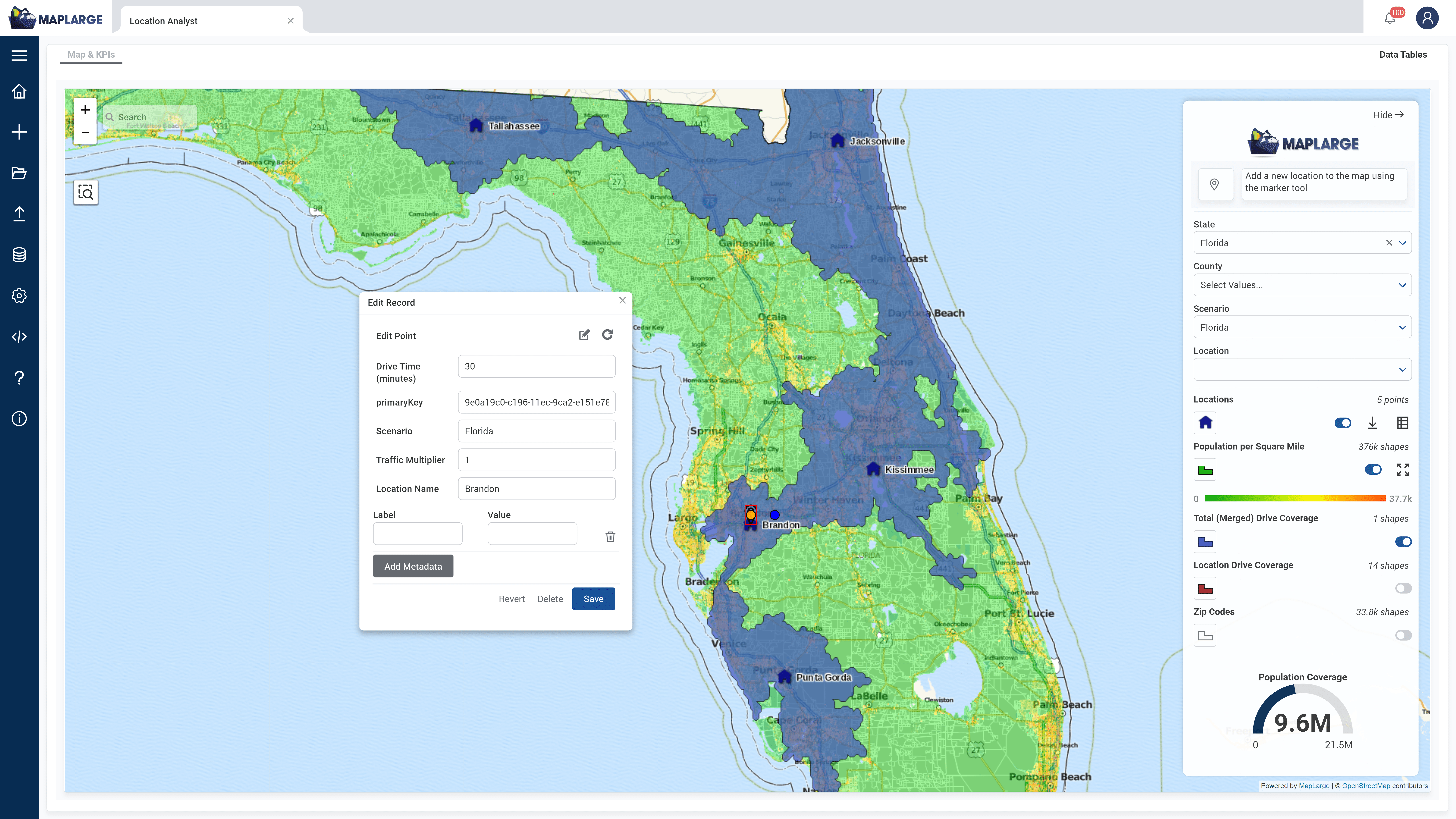
The dashboard UI enables quick context switching between dashboard building and visualization modes. The user interface and workflow simplicity allow non-developer staff to quickly create dashboard apps to address a myriad of use cases.
NO CODE APPLICATION CREATION
Hundreds of UI Components
Maps, Charts, Graphs & KPIs
HIGH DEFINITION
Visualize at High Definition
Inspect Individual Records
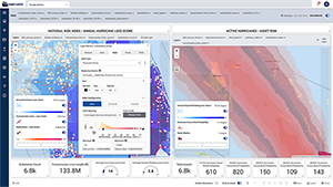
In this example use case, a power grid operator evaluates historic weather risks to their transmission line network. The low latency map updates provide a lower friction user experience with exploration at the speed of thought.
LIVE INTERACTIVE DASHBOARDS W/ LIVE DATA

Works with Billions of Records

Blend Multiple Data Sources at Scale
COLLECT DATA

Edit Any Record at Scale

Works Offline with Synchronization
Update Enterprise Records with Live Data Editing
Unlike most BI and GIS tools which can only passively view data, MapLarge offers live ACID compliant operations, enabling record edits by concurrent users at enterprise wide scale.
INTERACTIVE W/LIVE DATA
Works with Billions of Records
Blend Multiple Data Sources at Scale
COLLECT DATA
Edit Any Record at Scale
Works Offline with Synchronization
Simplify Your Workflow Assembly
ETL workflows allow users to intuitively interact with a multitude of data sources and condition them into end-to-end workflows. Workflows include data cleansing, transformations, aggregates, joins, queries, and analytics. Coupling this capability with easy-to-use security and data governance features, data products and visualizations can be produced and managed quickly and securely.
DEEP VISUAL ETL CAPABILITIES

Rapid End to End Workflows

Security & Data Governance
REPORT

Formatted Reports in Multiple Formats

Notifications via Text, Email, and In App
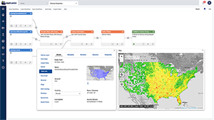
MapLarge’s ETL Notebooks provide a no-code workflow approach to constructing visual analytic products. The modular construction of serial and parallel processing pipelines provides a systematic approach to ingest, transformation, analytics, and visualization.
DEEP VISUAL ETL CAPABILITIES
Rapid End to End Workflows
Security & Data Governance
REPORT
Formatted Reports in Multiple Formats
Notifications via Text, Email, and In App
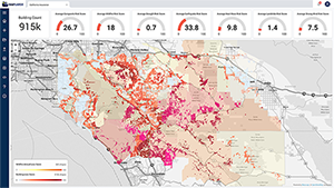
In this example use case, a utility operator evaluates current and historic wildfire risks to their power grid. Filters applied to the data layers rapidly update Key Performance Indicators (KPI).
DEEPLY EXTENSIBLE COMPONENTS WITH OPEN APIs

JavaScript/TypeScript

REST APIs

Embeddable in Custom Applications
Work Offline in the Field with Synchronization
MapLarge aids enterprises in breaking out of connectivity limited apps and into a full-featured offline field operations experience that can opportunistically sync with MapLarge servers in the cloud, hybrid, or private environments when connectivity is available. MapLarge's mobile deployments work on or offline and incorporate use of GPS and other mobile sensors for personnel or fleet tracking, routing, and navigation.
DEEPLY EXTENSIBLE COMPONENTS WITH OPEN APIs
JavaScript/TypeScript
REST APIs
Embed in Custom Apps


