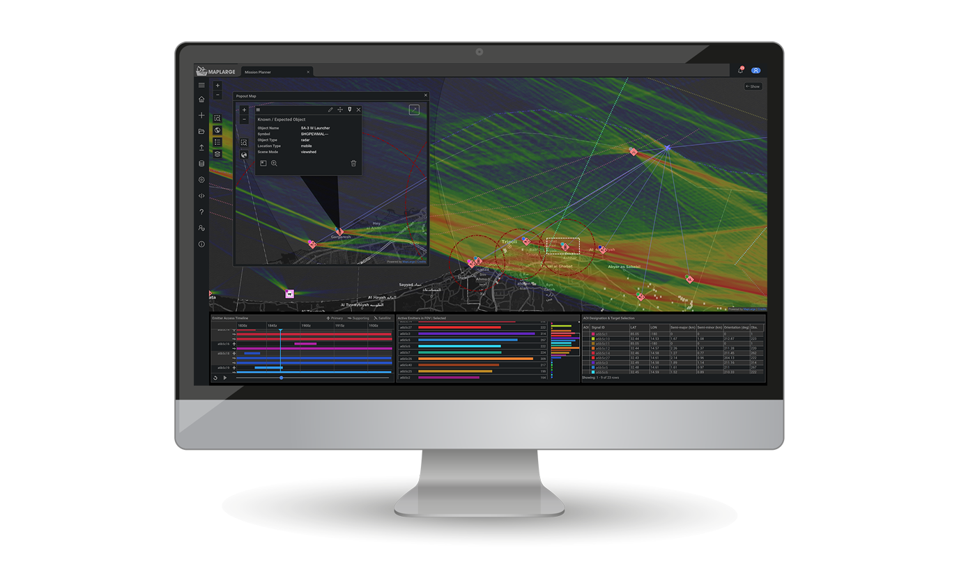
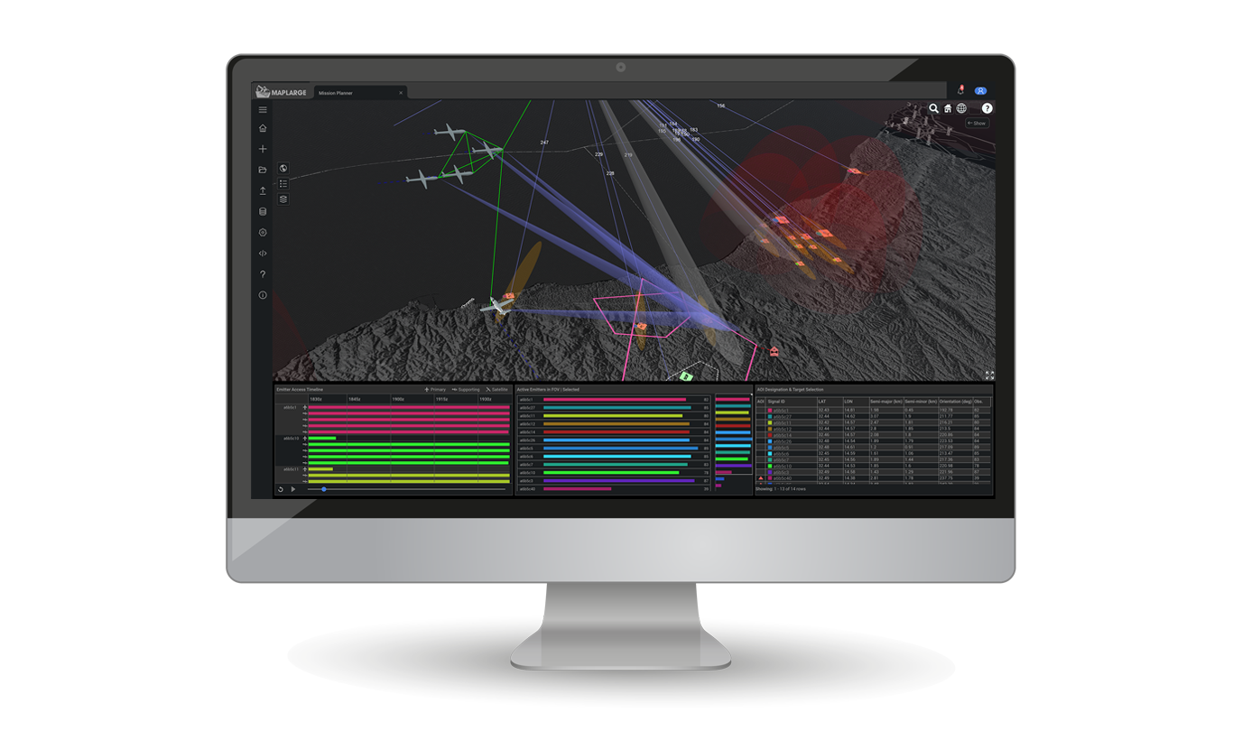
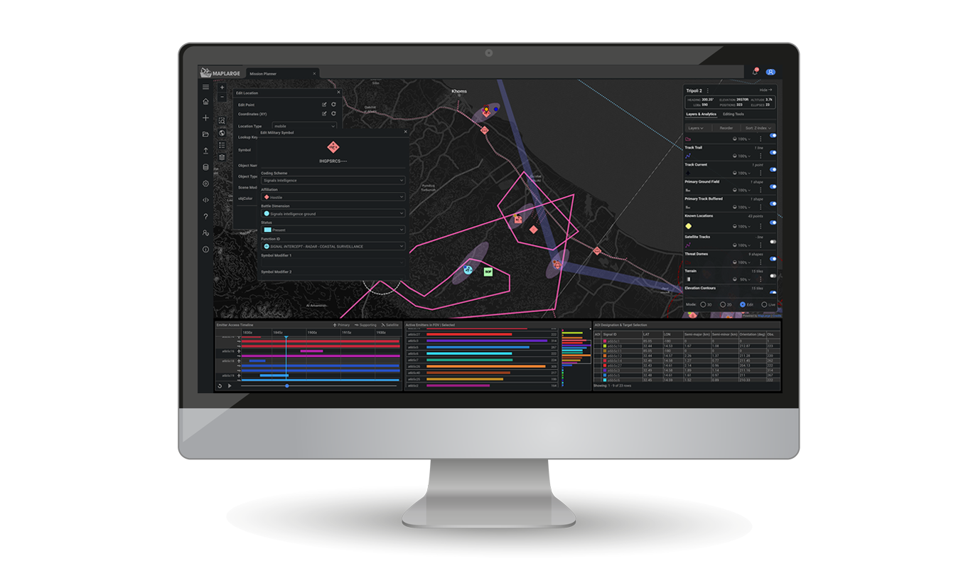
MapLarge's ISR Mission Manager provides a collaborative mission orchestration framework for multi-domain operations by integrating multi-sensor data in automated tasking, collection, processing, exploitation, and dissemination (TCPED) workflows.
- Build real-world operational scenarios.
- Simulate, optimize, & execute the mission.
- Rapidly prototype & field new solutions.
- Fasttrack data & services dissemination.
- No ITAR restrictions for Mission Partners.
Enhance Mission Readiness & Effectiveness Across ISR Mission Stakeholders

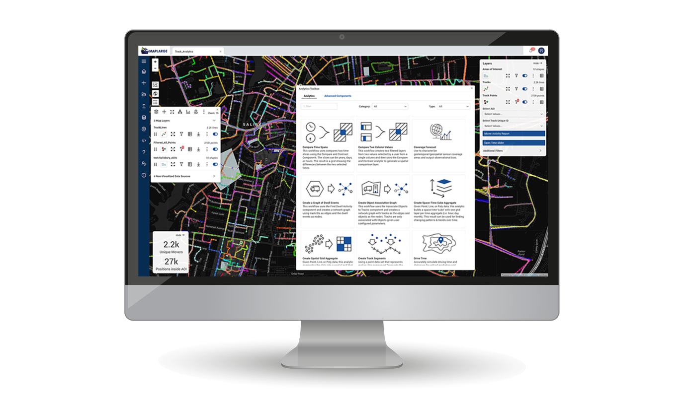
Bring Together Any Data, Analytics, & Visualizations in Workflows
COTS TRL 9 solution integrates stovepiped vendors into a common framework, spanning pre-mission planning, live operations, and post-mission PED for collaboration among ISR Ops/Intel stakeholders.
A Government Agency uses MapLarge to unify and synthesize over 250 different endpoints, with millions of geospatial data objects, into a state-of-the-art user experience to reduce time from analysis to production through a single queryable and accessible service.

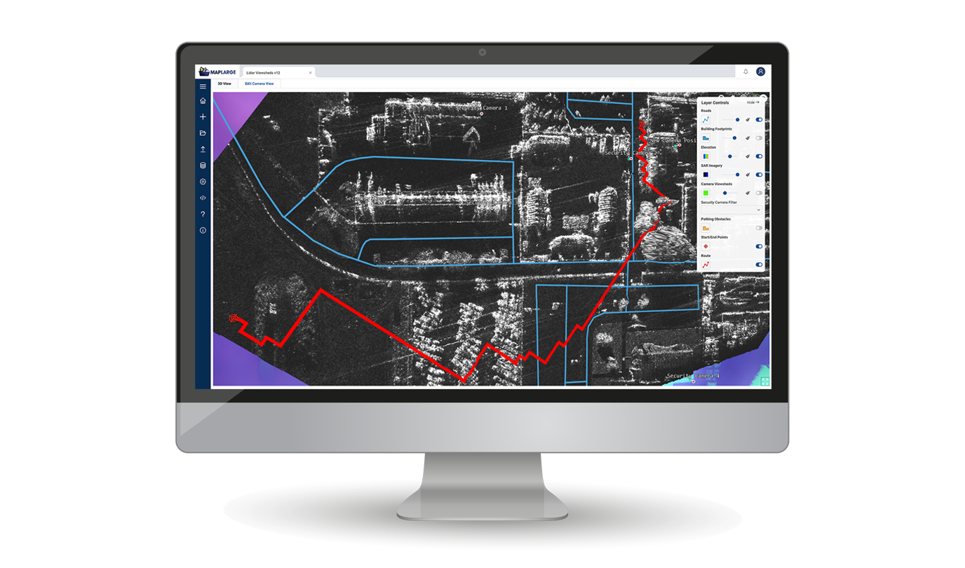
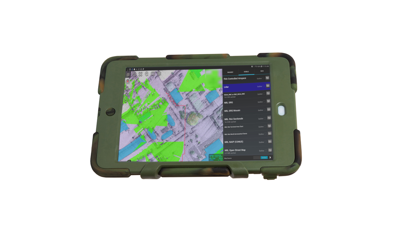
Automate Real-time Ops with RF Edge Processing
Integrate multi-sensor data streams with performant ingest, query, and on-the-fly transforms. Run the MapLarge App stack on small SWaP-C devices; pipe collected data to enterprise lakes when connected.
A Global Aircraft Engine Supplier and growing list of International Airlines use the MapLarge Platform for flight optimization to improve safety and efficiency.

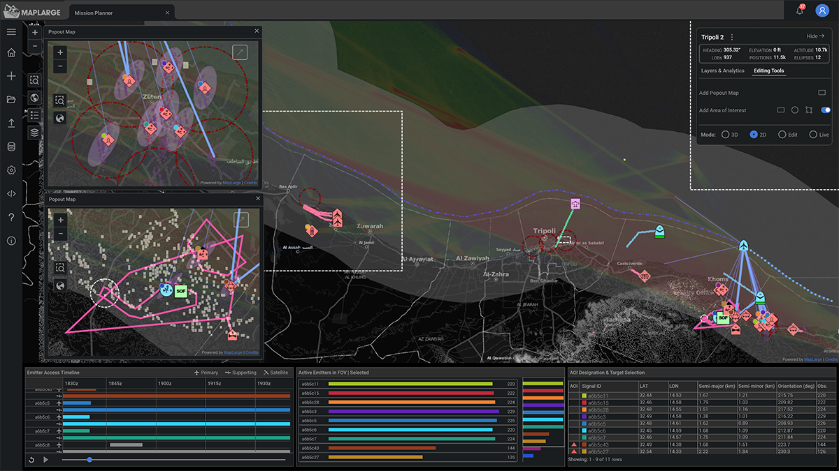
Accelerate Data to Tactical and Airborne Ops
Expedite validated data and products to tactical users via mobile handheld, forward PED, and Airborne ISR deployments, including support for intermittent, disrupted, and disconnected operations.
A MapLarge program provides a compromised asset interdiction suite (software + custom IoT hardware) for Federal/State Law Enforcement to combat cyber financial crimes in the field.