Automated Commercial Data Workflows Providing Ops-Ready Intel for Tactical Users
MapLarge's Tactical Edge Data Services delivers multi-source data and capabilities from the enterprise-connected Operations Center to disconnected field users on any mobile tactical device, mission system, or unattended sensor in any Warfighting domain.
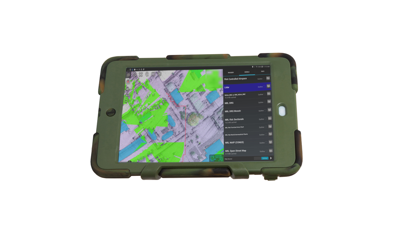
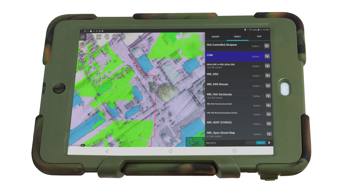
- Runs on small SWaP-C & tactical mobile systems.
- Disconnected & intermittently-connected Ops support.
- Push-button apps for actionable intelligence.
- Modular Open Systems Architecture (MOSA).
- Extensible for Quick Reaction Capabilities RDT&E.
- No ITAR restrictions for Mission Partner collaboration.
Enhance Mission Readiness & Effectiveness at the Tactical Edge

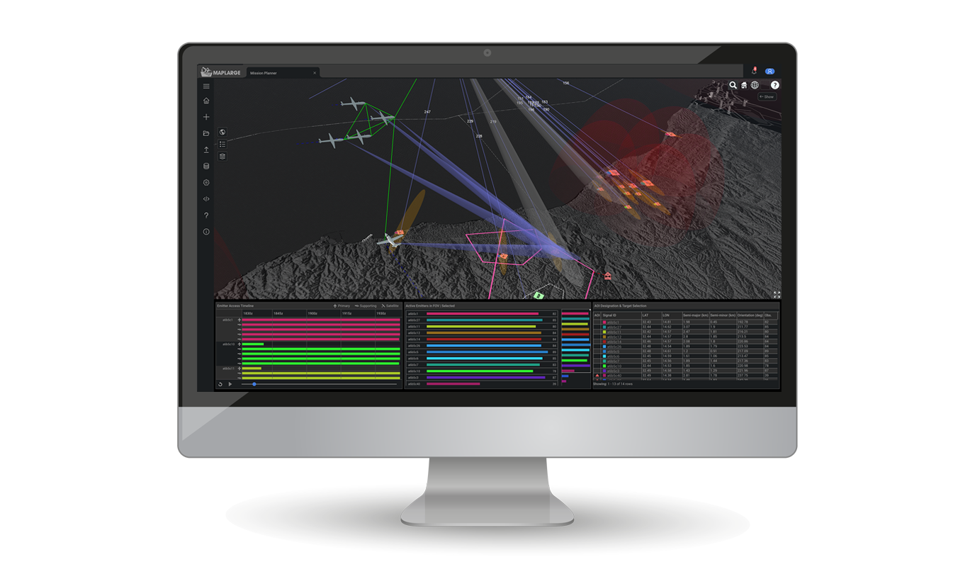
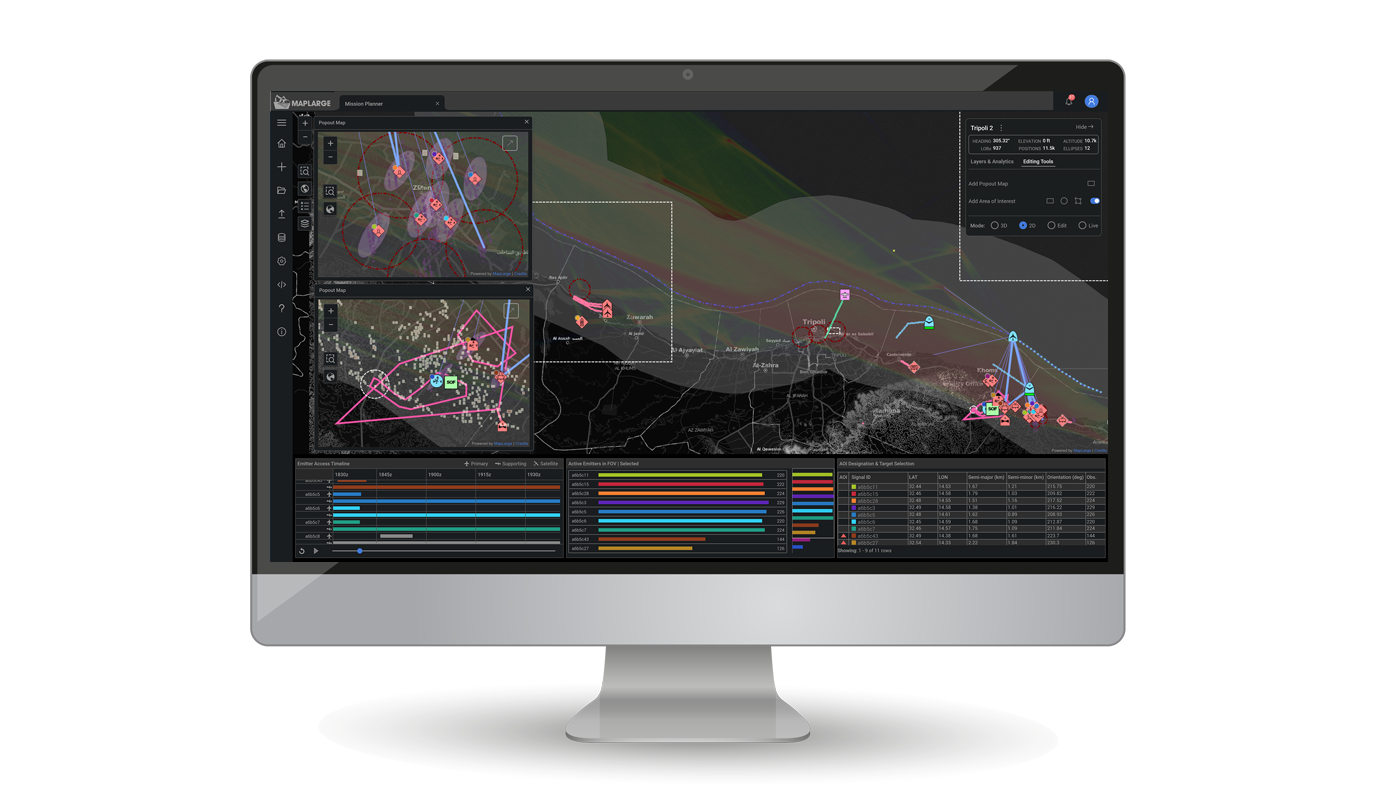
Sync Common Operational Picture with Forward Deploying Teams
Integrate stovepiped multi-source enterprise data and services into a shared pre-mission planning and simulation environment. Preload mission data package in tactical gear and mission systems.
A Government Agency uses MapLarge to unify and synthesize over 250 different endpoints, with millions of geospatial data objects, into a state-of-the-art user experience to reduce time from analysis to productionthrough a single queryable and accessible service.

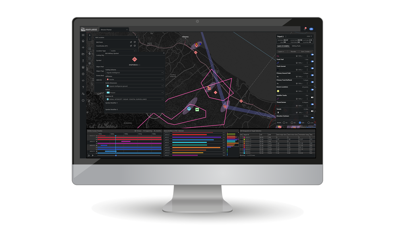
Drive Live Operations on Edge Nodes and Air-Gapped Mission Systems
Run the same MapLarge App stack on small SWaP-C devices such as TAK, UAS, Forward PED, and Airborne/Maritime ISR deployments. Access enterprise services and pipe edge collected data to lakes and stores when intermittently connected.
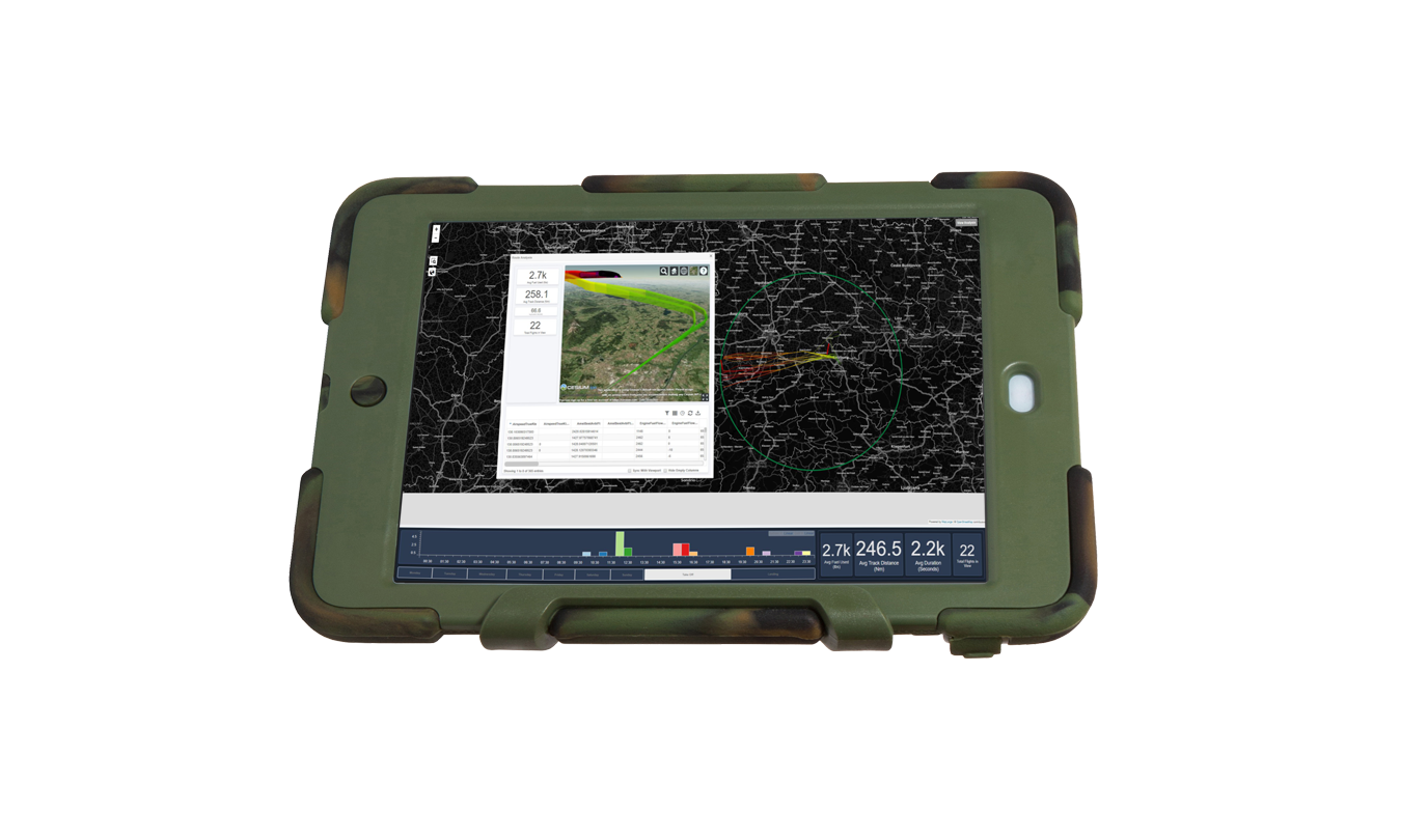
A customer deployed MapLarge's route-optimization app on ruggedized tablets to support intermittently-connected field technicians access to broad-area fixed sensor array, accident/incident reporting, and weather. Field operators formed nodes of the network, collectively providing input to optimize the team's planning and routing for safety and productivity.

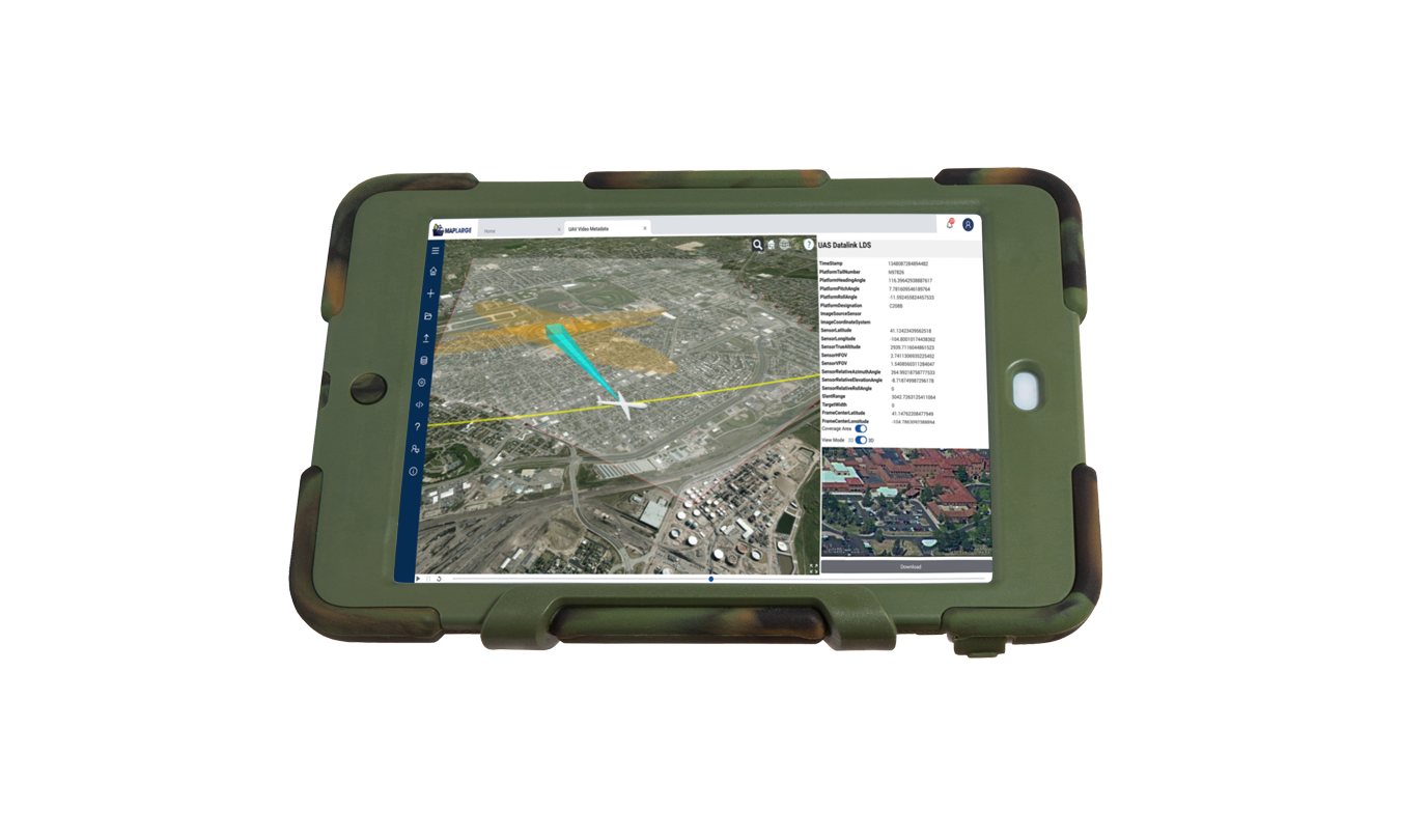
Support Disconnected Ops with Push-Button Maneuver & Infil/Exfil Routing
Expedite validated data and capabilities to tactical users on mobile handheld devices, including support for intermittently-connected, disrupted, disconnected, and limited bandwidth (DDIL) operations. Push-button plugins provide intelligent viewshed, terrain, and objective-based routing.
A MapLarge program provides a compromised asset interdiction suite (software + custom IoT hardware) for Federal/State Law Enforcement to combat cyber financial crimes in the field.